Latitude and Longitude to Address Converter
Convert latitude and longitude coordinates into complete street addresses instantly. Our free reverse geocoding tool supports batch processing, interactive map preview, and CSV export — fast, accurate, and easy to use worldwide.


Latitude and Longitude to Address Converter
The Latitude and Longitude to Address Converter allows you to instantly convert GPS coordinates into complete human-readable addresses. This process, known as reverse geocoding, transforms numeric latitude and longitude values into street address, city, state, and country details.
Whether you're working with mapping data, logistics planning, marketing datasets, or GPS exports, our tool supports batch conversion of up to 100 coordinate pairs at once — fast, accurate, and free.
What Is Reverse Geocoding?
Reverse geocoding is the process of converting geographic coordinates into a readable address format.
For example:
40.730610, -73.935242
Becomes:
1600 Broadway, New York, NY 10019, USA
This is widely used in GIS systems, delivery services, mobile applications, and location-based analytics.
Why Convert Latitude and Longitude to Address?
Key Features of Our Tool
Convert multiple latitude-longitude pairs in a single operation.
Click once and receive structured address results immediately.
Verify every converted coordinate visually on the map.
Export results in CSV format compatible with Excel and Google Sheets.
No coordinate storage. Data is processed securely.
How to Convert Latitude and Longitude to Address
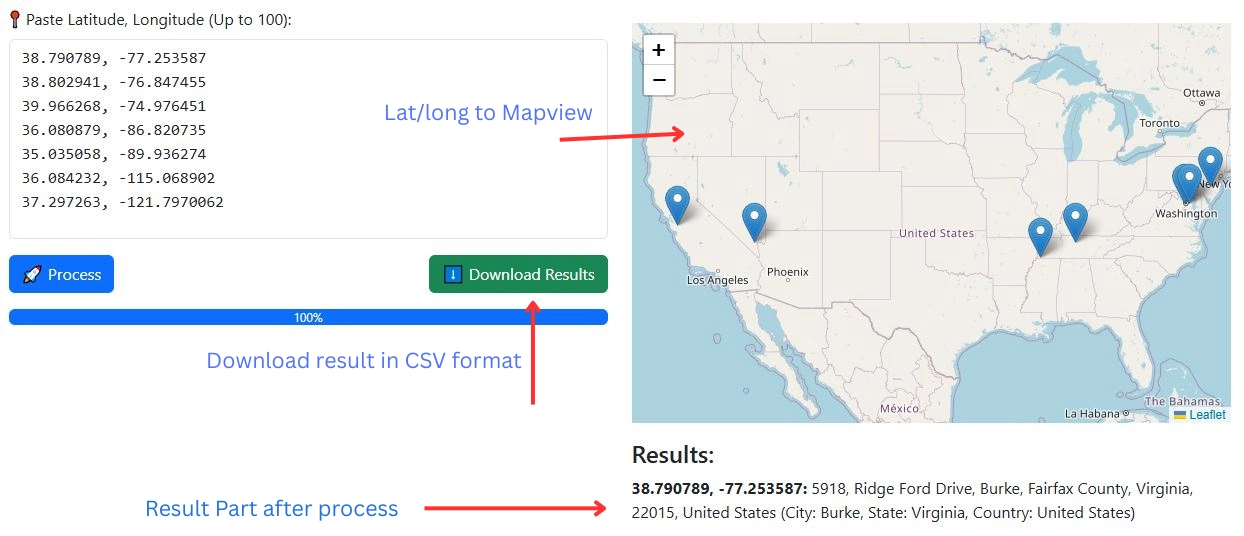
- Paste Coordinates
Enter latitude and longitude pairs (one per line). - Click Convert
The tool processes each pair using reverse geocoding. - View Address Results
See full address details including city, state, and country. - Download CSV
Export results for spreadsheet or database use.
Privacy First
We do not store your latitude, longitude, or converted addresses. All data is processed securely and cleared after session completion.
FAQ on Latitude and Longitude to Address Converter
To convert latitude and longitude to an address, paste your coordinate pair (example: 28.6139, 77.2090) into the tool and click the Convert button. The reverse geocoding system processes the coordinates and returns a full street address including city, state, and country.
Reverse geocoding is the process of converting geographic coordinates (latitude and longitude) into a human-readable address. It is commonly used in GPS systems, delivery services, GIS applications, and mapping platforms.
Our Latitude and Longitude to Address Converter supports batch conversion of up to 100 coordinate pairs at a time. You can process multiple lines in one go and download results as a CSV file.
Yes. After processing your coordinates, you can download the results as a CSV file. The file includes latitude, longitude, full address, city, state/region, and country columns.
Yes, this reverse geocoding tool is completely free to use. There are no signups required and no daily limits beyond the 100 coordinates per batch.
No. We do not store or save your latitude, longitude, or converted addresses. All data is processed securely and cleared after your session ends.